UN
78 Hugin Avenue
£ 179,800
Description
We don't have a Description for this property.
- Bedrooms
- 3
- Bathrooms
- 0


Leaflet © OpenStreetMap contributors
The heatmap indicates the level of crime in the area. The color of the heatmap indicates the crime severity and recency.
Metrics Year-on-Year
- Average area value
- 439,763.00 £Increased by 13.61 %
- Average area rental value
- 1,600.00 £/moIncreased by 24.71 %
- Est rental Yield
- 4.37 %Increased by 9.80 %
- Crime Rate
- 20.00 %Unchanged by 0.00 %
from 387,074.00 £
from 1,283.00 £/mo
from 3.98 %
from 20.00 %
Nearby Schools
| Name | Type | Ofsted | Distance |
|---|---|---|---|
| Kms Kent Ltd | Special Post 16 Institution | 0.35 KM | |
| Cross Keys Learning | Other Independent Special School | Requires improvement | 0.35 KM |
| Callis Grange Children'S Centre | Children's Centre | 0.76 KM | |
| Callis Grange Nursery And Infant School | Community School | Outstanding | 0.88 KM |
| St Peter-In-Thanet Cofe Junior School | Voluntary Aided School | Good | 1.03 KM |
Images
Nearby Streets
| Name | Average Price | Average Sqft | Distance |
|---|---|---|---|
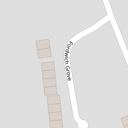
| Fordwich Grove | £ 315,000 | 0 | 0.00 KM |
| Albert Road | £ 239,983 | 0 | 0.00 KM |
| Napier Road | £ 250,000 | 0 | 0.00 KM |
| Grafton Road | £ 375,000 | 0 | 0.00 KM |
| Link Road | £ 507,250 | 0 | 0.00 KM |
Nearby Transport
| Name | NLC | TLC | Distance |
|---|---|---|---|
| Broadstairs | 5006 | BSR | 2.04 KM |
| Dumpton Park | 5034 | DMP | 3.13 KM |
| Ramsgate | 5023 | RAM | 3.91 KM |
| Margate | 5018 | MAR | 5.49 KM |
| Westgate-On-Sea | 5195 | WGA | 9.09 KM |
Nearby Listings
| Address | Price | Type | Score | Distance |
|---|---|---|---|---|
| Hugin Avenue St Peters | £ 335,000 | BUY | 7 / 10 | 0.00 KM |
| Hugin Avenue, Broadstairs, Kent | £ 375,000 | BUY | Unknown | 0.02 KM |
| Hugin Avenue, Broadstairs, CT10 | £ 350,000 | BUY | 7 / 10 | 0.11 KM |
| Hugin Avenue, Broadstairs, CT10 | £ 325,000 | BUY | 7 / 10 | 0.11 KM |
| Whitfield Avenue, Broadstairs | £ 335,000 | BUY | 7 / 10 | 0.14 KM |
Nearby Properties
| Address | Price | Distance |
|---|---|---|
| 119 Hugin Avenue | £ 160,000 | 0.00 KM |
| 106 Hugin Avenue | £ 172,000 | 0.00 KM |
| 118 Hugin Avenue | £ 255,000 | 0.00 KM |
| 84 Hugin Avenue | £ 170,000 | 0.00 KM |
| 123 Hugin Avenue | £ 100,000 | 0.00 KM |